In the previous blog posting there are photos of the clear-cutting that's taken place at
228th & 39th.
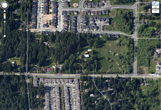
It's obvious, in the blog photos many trees have been cut, and if you refer to the Google Map images, the houses located next to the now tree-less property HAD large trees at their fence line.
The trees next to the houses have been cut and from the photos in the previous blog, you can see large machines parked very close to those houses.
Photo 1.
228th is at the bottom edge of the photo.
The yellow dot in the wooded area is where the photos were taken of the clear cutting.
The yellow dow, top right corner, is where the "Protected Growth Protected Area" sign was located.
Photo 2.
Wider view of the 228th & 39th property
I've highlighted information pertinent to the 228th & 39th property.
You can see that 5.5 million dollars of Brightwater Mitigation funds were spent on purchasing and developing the property.


No comments:
Post a Comment